- Stock: In Stock
- Model: 00-00012534
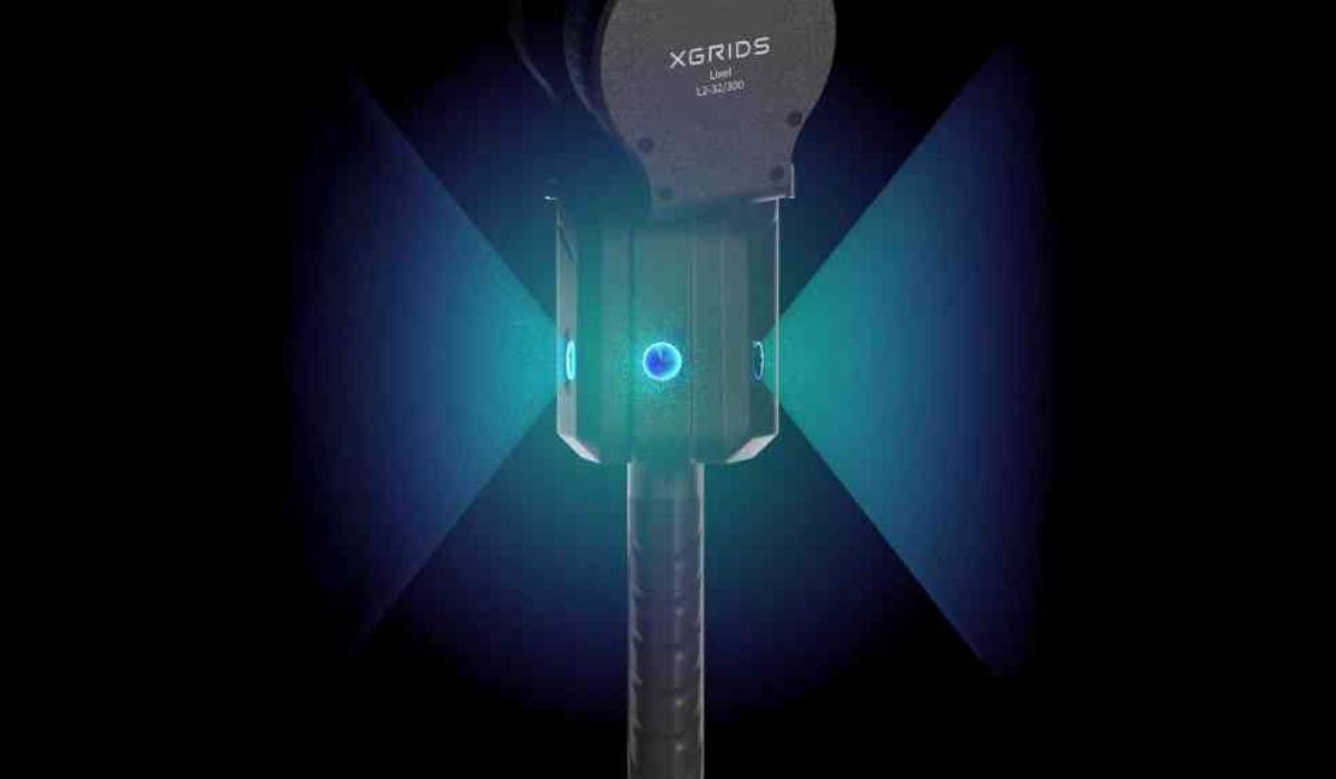
3D Scanner with Color Cameras XGRIDS L2 Pro 16/120 Standard Package
The 3D scanner with color cameras and LiDAR XGRIDS L2 Pro 16/120 is an advanced handheld laser scanner. It changes the perception of traditional 3D scanning. The device combines real-time scanning and modeling. The obtained data does not require post-processing; it can be used immediately after scanning. The compact 3D scanner is equipped with visual sensors. It also has inertial measurement units (IMU). The scanner uses artificial intelligence in its operation.
Innovative Device Capabilities with Artificial Intelligence
The scanner provides high-quality point cloud data in real time. The data is so accurate that it can compete with results after post-processing. This opens a new era of "zero post-processing" for SLAM devices (Simultaneous Localization and Mapping). This approach significantly speeds up the workflow and increases overall efficiency.
Key Advantages of XGRIDS L2 Pro 16/120
- Fast recording and instant visual control: this is ideal for field work.
- Real color model: it is in demand in architecture, GIS, VR, and construction.
- Portability and autonomy: this compact device does not require a large tripod.
- High accuracy and data density: the scanner provides 1 mm/point. Data density reaches 1 million points/m².
- IP54 (dust, drips): this protection level is sufficient for most conditions. However, it is not designed for heavy rain or mud.
- Geopositioning error: the scanner without RTK is inferior to a total station in geopositioning accuracy. However, the error is only ±3 cm. This is within acceptable limits.
Uniqueness and Operating Principle of XGRIDS L2 Pro 16/120 Standard Package
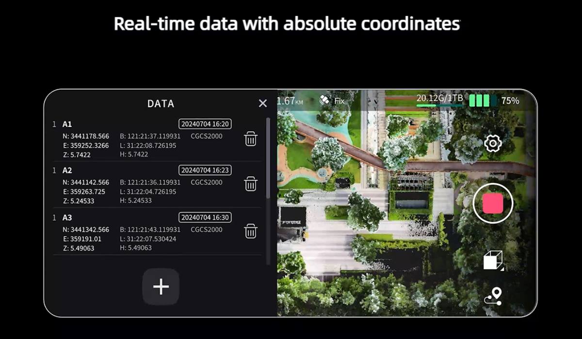
The uniqueness of Lixel L2 Pro lies in its ability to provide true real-time SLAM. The device instantly outputs point cloud data. This data is immediately ready for use. There are no delays for post-processing. The real-time coloring effect achieves quality comparable to processed data. This ensures immediate data readiness for further application.
Operating Principle of the Lixel L2 Pro Scanner
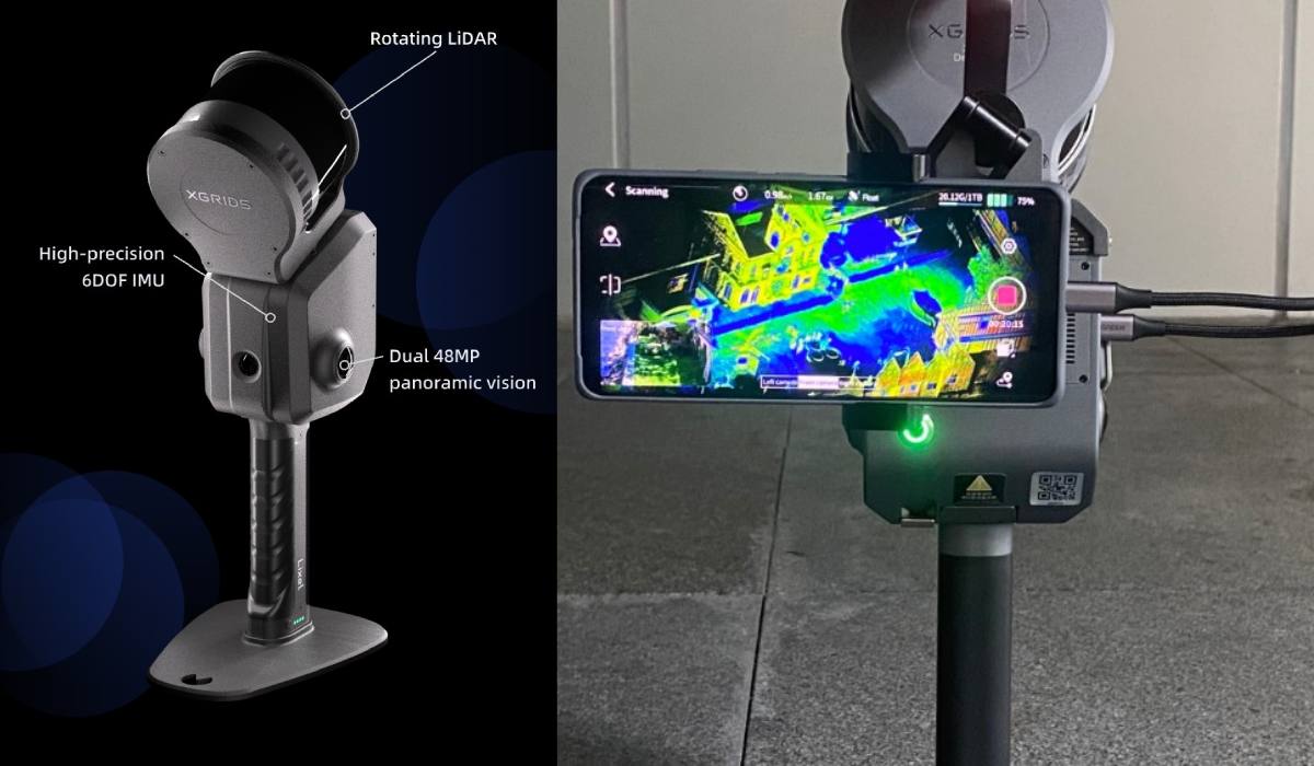
The operating principle of the Lixel L2 Pro scanner is based on full integration. Deep optimization of updated sensors is also used. It is equipped with a rotating scanner. It has a high-precision IMU with 6 degrees of freedom. These elements are combined with vision modules and artificial intelligence. This allows obtaining accurate and detailed environmental data. The system provides stable and reliable navigation. This works even in challenging conditions. Panoramic vision has a resolution of 2×48 Megapixels. It allows obtaining high-quality images. There is no need to use external cameras.
Differences between XGRIDS L2 Pro and Surphaser
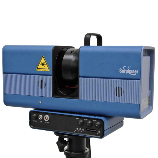
How Surphaser Works
Surphaser is a heliospherical phase-shift laser scanner. The laser and mirror system rotate in two planes. This is 360° vertically and 270° horizontally. It reflects a laser beam. The scanner captures the precise geometry of objects. The result is a dense point cloud. Its accuracy reaches sub-millimeter values.
How XGRIDS L2 Pro Works
The compact SLAM scanner combines a 360° LiDAR sensor. It has stereo/panoramic cameras (56 million pixels). During the scanning process, the device performs SLAM algorithms. This is needed to build a model in real time. The scanner provides a color 3D model with centimeter accuracy. XGRIDS does not rotate mirrors like Surphaser. It uses mobile positioning. It also uses user movement. Continuous data processing guarantees an accurate result.
Scanning Stages with XGRIDS L2 Pro
1. LiDAR Scanning
LiDAR (laser rangefinder) emits infrared laser pulses (905 nm). This happens in all directions. A rotating module is used. When a pulse reflects off an object, the scanner measures the signal return time. This is needed to calculate the distance to it. This forms a "point cloud". It represents a three-dimensional model of space.
2. Digital Camera for Color
Built-in 48 MP panoramic cameras capture color images of the scene. These images are tied to the LiDAR cloud. This creates a color three-dimensional model (RGB points).
3. IMU + AI-SLAM
The integrated inertial module (IMU) tracks movement. It also determines the device's orientation. Thanks to SLAM (Simultaneous Localization And Mapping) algorithms, the scanner accurately determines its own position. This works even without GPS.
4. Real-time Data Processing
The built-in computer instantly combines data. It uses information from LiDAR, cameras, and IMU. This forms a color point cloud model. There is no need for further "serious" post-processing. Four powerful algorithms yield an outstanding result.
Obtaining Ready Digital Models
To obtain ready-to-use digital models, the following steps are performed:
- Power on: the LiDAR module rotates (about 10 seconds). Connection with the camera/IMU is established.
- Start scanning: the laser moves and sends pulses. Panoramas are simultaneously captured.
- AI + SLAM: data is collected in real time. Range and color cloud are visible on the phone or tablet.
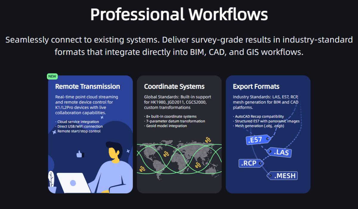
- Save cloud: the cloud is saved to a .las file. Further processing takes place in Lixel Studio / CyberColor.
Key Characteristics and Advantages of the XGRIDS L2 Pro 16/120 Scanner
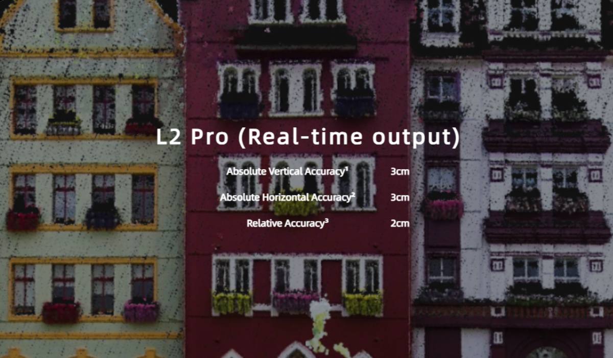
High Accuracy
Lixel L2 Pro demonstrates high accuracy performance. Absolute vertical and horizontal accuracy (RMSE) is 3 cm (without RTK and at distances less than 100 m). Measurement accuracy (RMSE) is 2 cm (for distances between two points less than 100 m). Processing accuracy is even higher. Absolute vertical and horizontal accuracy (RMSE) with GCP/RTK less than 100 m is also 3 cm. Measurement accuracy (RMSE) during processing reaches 1 cm. Repeatable accuracy (RMSE) is 2 cm.
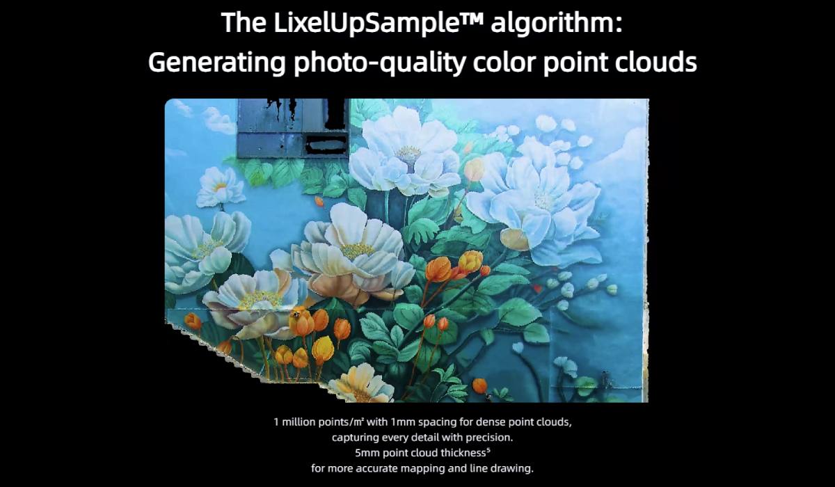
Ultra-thin Point Clouds
Thanks to the unique LixelUpSample™ algorithm, the device generates photographic quality point clouds. The step is 1 mm. This creates dense point clouds with 1 million points per square meter. The thickness of the point cloud is 0.5 cm. This ensures high accuracy in mapping and line drawing.
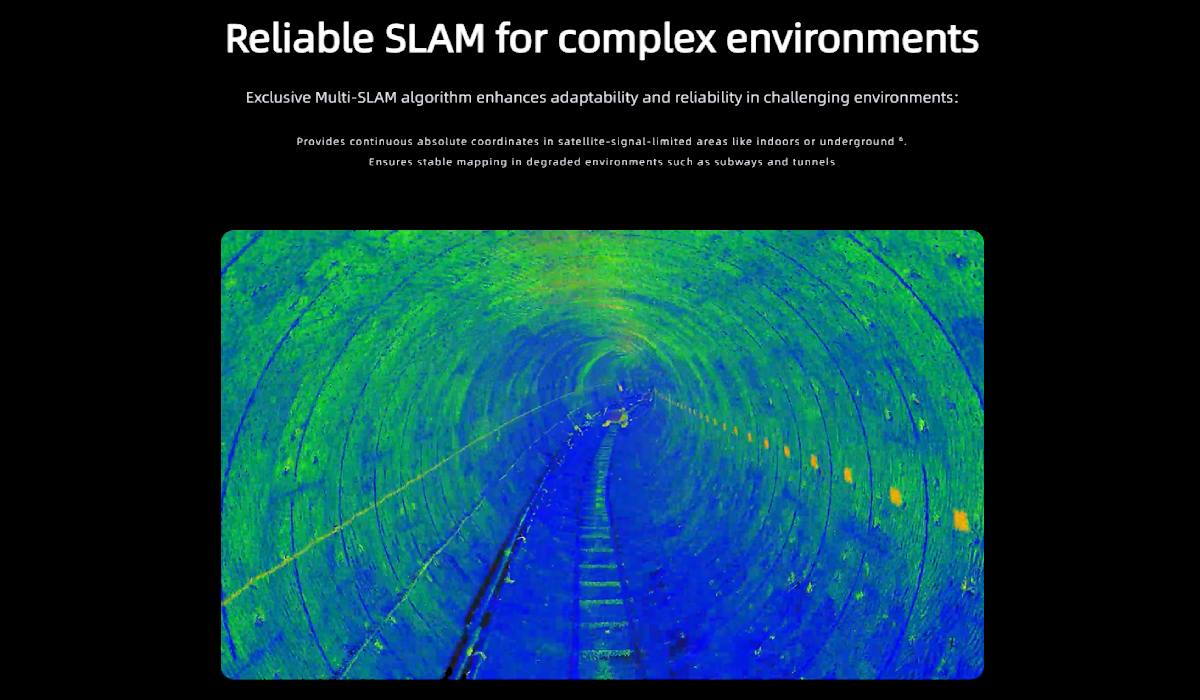
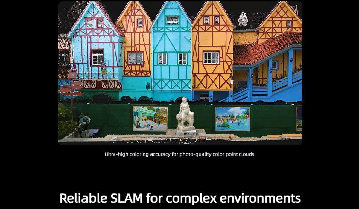
Reliability in Complex Environments
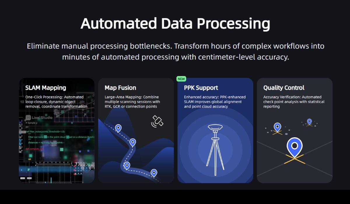
The exclusive Multi-SLAM algorithm significantly improves adaptability. It enhances the reliability of the device in conditions with limited satellite signal. Such conditions include indoor spaces, underground areas, subways, and tunnels. The algorithm ensures continuous acquisition of absolute coordinates. It guarantees stable mapping.
Additional Characteristics
- Wide operating range: the scanner operates in the range from 0.5 m to 120 m / 0.5 m to 300 m.
- High scanning speed: scanning frequency is 320,000 or 640,000 points/s.
- Long operating time: continuous operation time of the device is 90 minutes.
- Weight: the XGRIDS L2 Pro 16/120 3D scanner weighs only 1.6 kg.
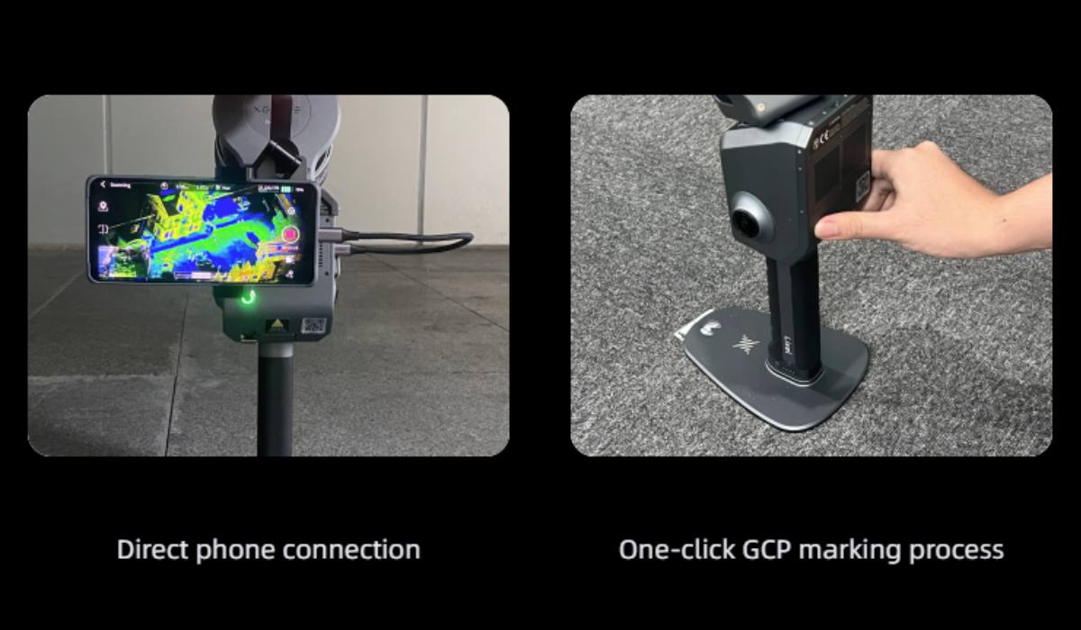
Convenient Workflow
The device supports accurate verification reports. It has direct phone connectivity. The GCP control point marking process is done in one click.
Interfaces and Memory
Lixel L2 Pro is equipped with a USB 3.1 Gen2 interface. It has a built-in 1 TB SSD.
Wireless Connections
WiFi (802.11a/b/g/n/ac) and Bluetooth are supported.
Protection Level
The device has an IP54 protection rating. This ensures its protection from small amounts of drips.
RTK Support
Lixel L2 Pro supports real-time RTK merging. Standard RTK supports GPS L1/L2/L5, GLONASS L1/L2, BDS B1/B2/B3, Galileo E1/E5a/E5b/E6b channels. Horizontal accuracy is 0.8 cm + 1 ppm. Vertical accuracy is 1.5 cm + 1 ppm. Geodetic RTK has similar characteristics.
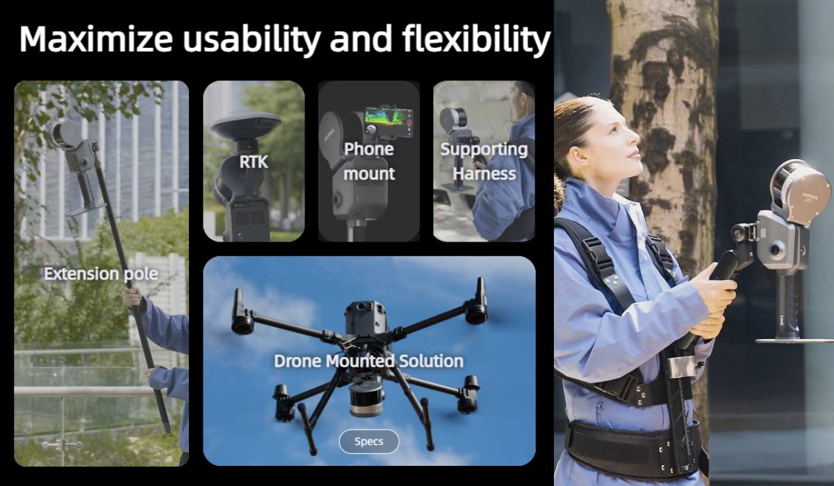
Auxiliary Accessories*
- Included or as additional accessories may be available:
- Backpack with stabilizing mount (60x60x15 cm, 2.5 kg).
- Backpack with soft padding (5x35x25 cm, 2.7 kg).
- Extension rod 2 m.
- Mobile phone holder.
- Control point plate.
- Transport case (42x34x18 cm, weight with system 6.6 kg).
*The manufacturer may change the configuration without notice. Please clarify the configuration with the manager during order processing.
Software
For full operation with the XGRIDS L2 Pro 16/120 3D scanner, a set of software is provided. It significantly expands its functionality.
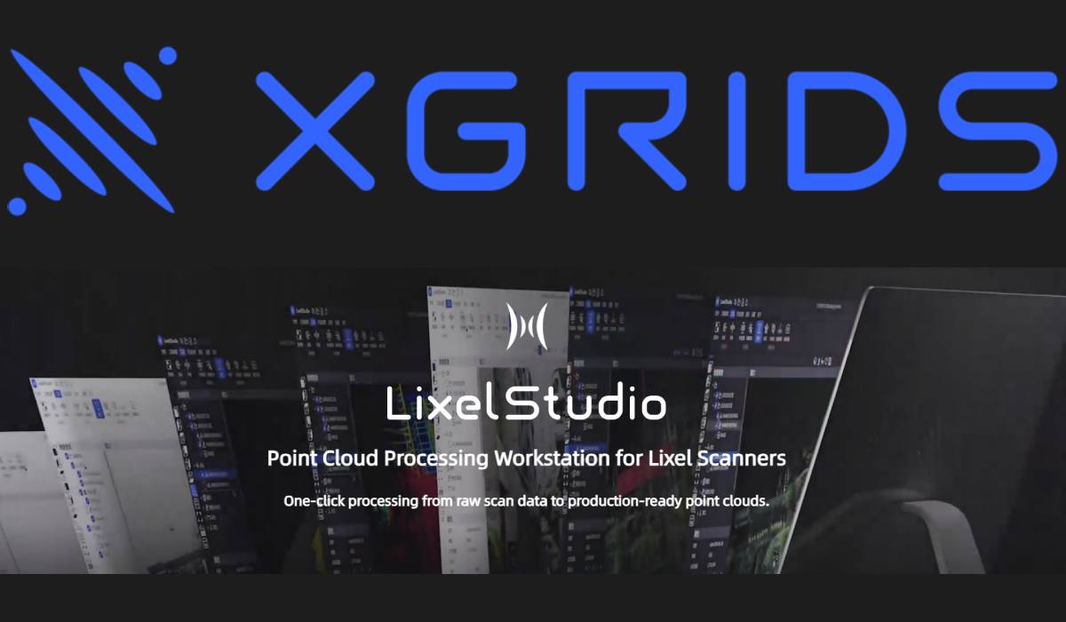
LixelStudio 3.0 is the primary desktop software. It is designed for professional point cloud processing. With it, you can import scanning data. You can perform filtering, registration, and optimization. The program allows you to create high-precision 3D models. It also supports data export to various formats. This ensures compatibility with other software.
Lyxel Cyber Color is a powerful application. It specializes in creating immersive 3D scenarios. The program allows you to color point clouds. You can generate photorealistic visualizations. This is especially useful for presentations or virtual tours. Lyxel Cyber Color uses advanced algorithms. They ensure high quality color reproduction and detail.
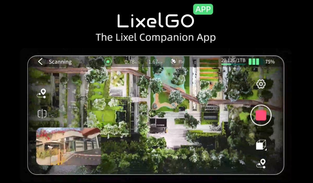
Lixel GO is a mobile application. It provides convenient control of XGRIDS L2 Pro 16/120 directly from your smartphone or tablet. With Lixel GO, you can start and stop scanning. You can monitor the process in real time. The application displays a preview of the point cloud. This allows for quick checking of data quality. You can also adjust scanning parameters. Lixel GO facilitates field work. It makes the scanning process more intuitive and efficient.
Using these software products together with XGRIDS L2 Pro 16/120 creates a complete ecosystem. It allows obtaining, processing, and visualizing 3D data at the highest level.
Application of XGRIDS L2 Pro 16/120 3D Scanner
This scanner, due to its portability, accuracy, and real-time capabilities, becomes an indispensable tool in many areas where fast and high-quality 3D data acquisition is required.
Architecture and Construction
- Creation of accurate 3D models of buildings and structures for design and reconstruction.
- Documentation of the actual state of objects (as-built documentation).
- Quality control of construction and identification of deviations from the project.
- Planning and management of indoor space.
- Creation of floor plans and layout schemes.
- Monitoring of deformations and changes in structures.
- Estimation of work volumes and materials.
Geodesy and Cartography
- Topographic mapping and creation of digital terrain models (DTMs).
- Geospatial modeling and analysis.
- Creation of high-precision maps and plans.
- Surveying territories for various purposes.
Agriculture and Forestry
- Forest survey for timber stock assessment and logging planning.
- Monitoring of crop growth and condition.
- Planning and optimization of irrigation systems.
- Creation of digital elevation models for soil analysis.
Smart Cities and Urban Planning
- Creation of digital twins of cities for infrastructure management.
- Planning the development of the urban environment and traffic flows.
- Monitoring the condition of roads, bridges, and other urban facilities.
- Analysis of urban development and population density.
Engineering Surveys and Infrastructure
- Study of geological and geomorphological features of the territory.
- Design and laying of communications (pipelines, cables).
- Inspection and maintenance of infrastructure facilities (power grids, railways).
- Monitoring the condition of bridges, dams, and other engineering structures.
Industry and Manufacturing
- Quality control of products and parts.
- Reverse Engineering for creating 3D models of existing objects.
- Modeling of production lines and workshops.
- Inventory of equipment and premises.
Oil and Gas Industry
- Survey of drilling platforms and infrastructure facilities.
- Monitoring the condition of pipelines and tanks.
- Planning maintenance and repair work.
Films, Games, and Virtual Reality (VR/AR)
- Creation of detailed 3D models of objects and environments for computer graphics.
- Development of realistic game worlds and virtual scenes.
- Scanning actors and objects to create digital twins.
- Creation of content for augmented and virtual reality applications.
Archeology and Cultural Heritage
- Documentation and preservation of historical monuments and artifacts.
- Creation of 3D models of ruins, buildings, and excavations.
- Virtual reconstruction of lost objects.
Security and Forensics
- Documentation of crime and accident scenes.
- Reconstruction of 3D scenes for analysis and investigations.
- Scientific research and education:
- Data collection for various scientific projects.
- Training students to work with 3D scanning and data processing.
Video review of the XGRIDS L2 Pro 3D scanner with 2 cameras
Our qualified managers will help you choose a 3D scanner for your specific needs. Contact us!