


- Stock: In Stock
- Product code: 00-00012545
- Shipping Weight: 1.00kg
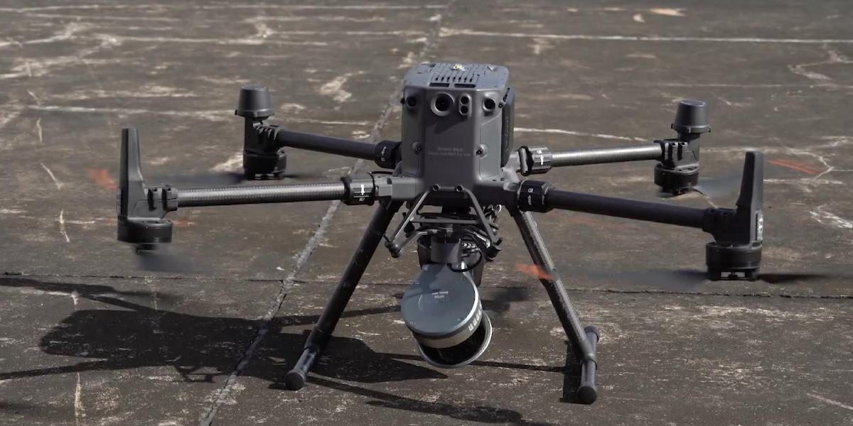
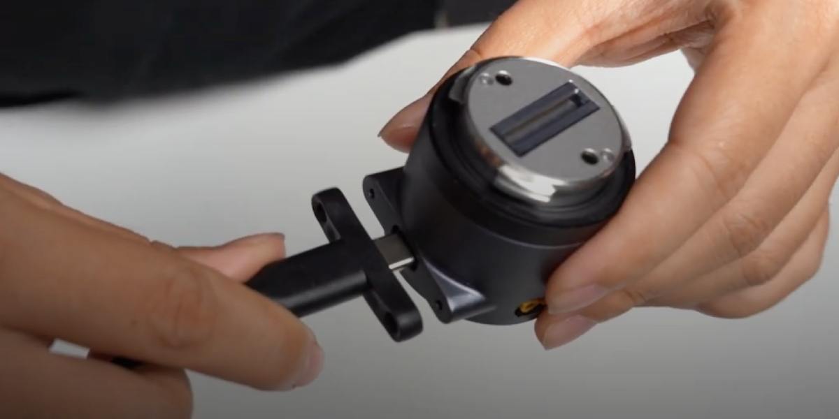
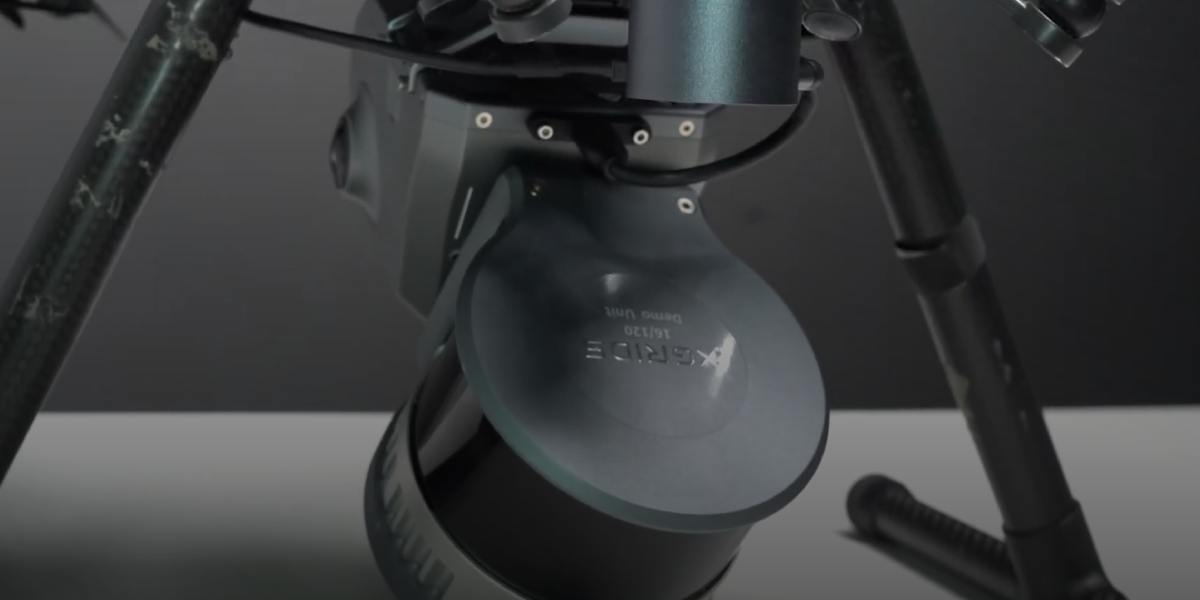
XGRIDS L2 Drone Mount: Bracket for attaching a 3D scanner to a Drone
The XGRIDS L2 Drone Mount (sometimes called a Drone Mounting Bracket or UAV Mount) is a special mounting bracket designed to integrate the XGRIDS Lixel L2 Pro scanner with unmanned aerial vehicles (drones). It allows the 3D scanning system to be lifted into the air, obtaining volumetric data and point clouds from a height, improving coverage and speeding up the scanning of large or hard-to-reach areas.

XGRIDS L2 Drone Mount Specifications
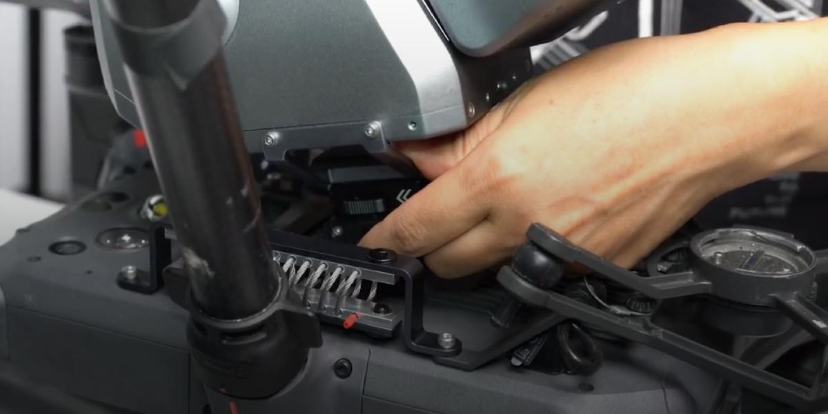
- Purpose: Mounting the Lixel L2 Pro on a drone / UAV, with fixation, adaptation to the drone's chassis.
- Compatibility with drone models: DJI Matrice 300 RTK and DJI Matrice 350 RTK are officially stated as compatible platforms.
- Mount weight: approximately 408 g (the mount itself without the scanner).
- Total system weight: the weight of the L2 Pro scanner + mount is approximately 2.2 kg when using the Drone Mount.
- Flight height: recommended ~ 30 m, maximum ~ 50 m.
- Flight speed: recommended ~ 3 m/s, maximum ~ 5 m/s.
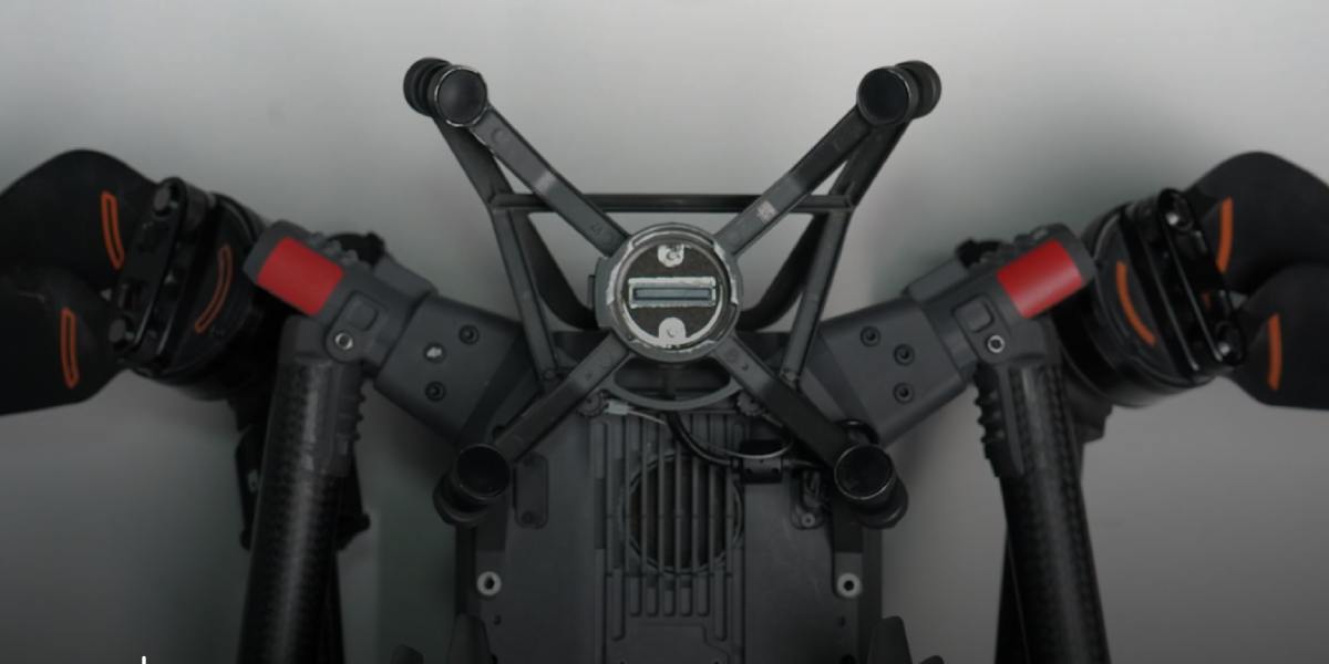
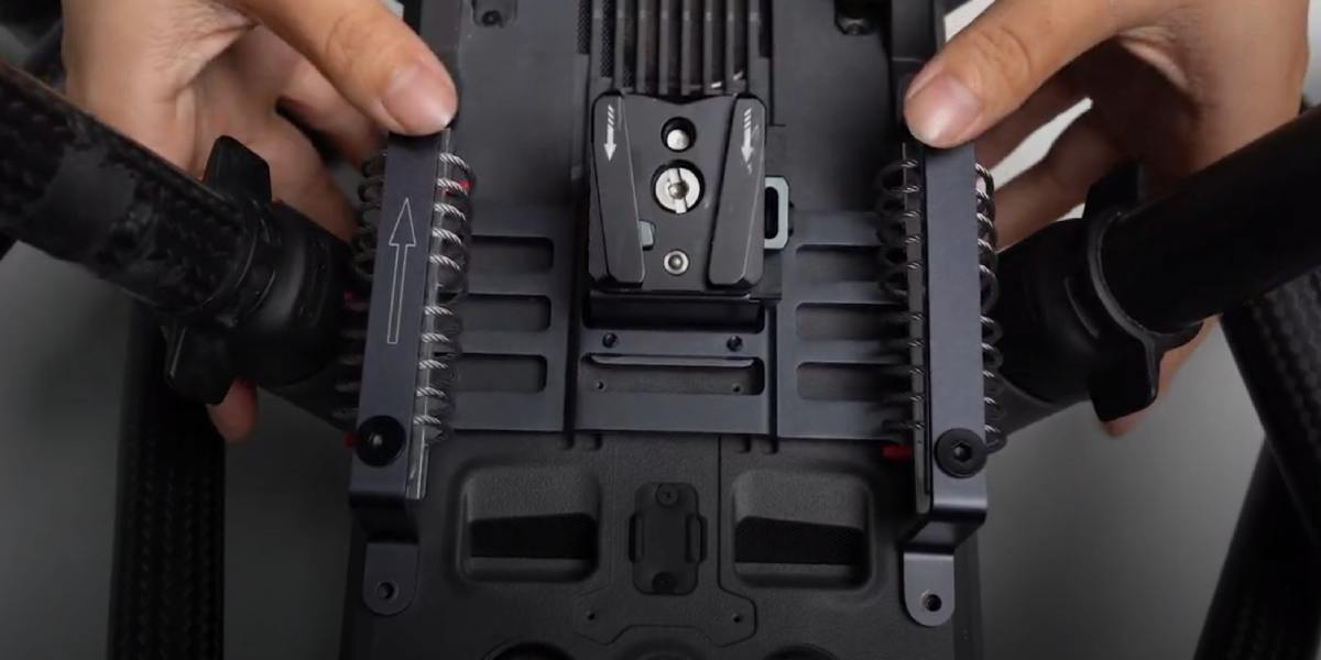
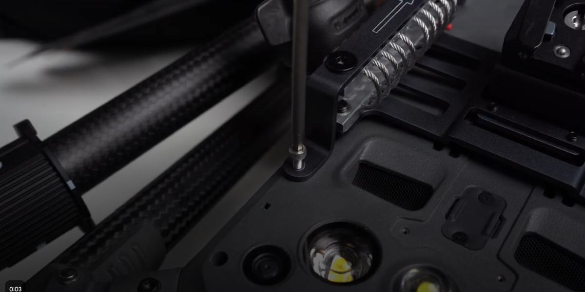
- Design features: vibration-dampened, stable mounting, low added mass, reliable fixation.
Equipment Compatibility
The mount is used with:
- Scanner: XGRIDS Lixel L2 Pro. This is the main device for which the bracket is made.
- Drones: officially supported are DJI Matrice 300 RTK and DJI Matrice 350 RTK.
Advantages of using the Drone Mount
- The ability to cover large areas faster and with less effort compared to ground or manual scanning.
- Access to hard-to-reach or dangerous places: roofs, slopes, remote objects, forest areas where it is difficult to walk.
- Obtaining point clouds from a height allows you to see objects from different angles, reduce shadow zones, reflections, and improve visibility.
- Improvement of the overall geometry of the point cloud: flat surfaces (roofs, ground), horizontal projections with fewer distortions.
- Reduced risk and costs: fewer control points, less contact with difficult terrain, fewer people in dangerous places.
Design features of the XGRIDS L2 Drone Mount
Vibration damping: the design is made to reduce the effect of drone vibration on the quality of LiDAR scanning. This is critical because vibrations can cause noise in the point cloud and distortions.
Low added mass: about 408 g, which does not significantly reduce the drone's flight time.
Reliable fixation of the scanner and no backlash: the bracket is specially designed for the shape of the L2 Pro body to ensure a rigid mount.
Optimized mounting points, cable routes, power adapter (if required) - everything is made in such a way that the integration is convenient and safe. (stated in sales descriptions).
Tasks and areas of use
Where and for what tasks the Drone Mount is especially useful:
- Topographic survey by aerial method: creating digital surface models, terrain maps where ground scanning is difficult.
- Monitoring of terrain changes, agriculture, and forestry: volume calculation, vegetation review, erosion control.
- Checking the condition of infrastructure: roofs, bridges, power lines, communication lines, objects at a height.
- Construction and construction control: progress monitoring, documentation of complex objects from above.
- Archeology, cultural heritage: objects located in hard-to-reach places, an overhead view facilitates scanning and minimizes intervention.
- 3D scanning objects after natural disasters or in emergency conditions when ground access is limited or dangerous.
Point cloud accuracy and influencing solutions
What solutions and design elements help achieve high accuracy:
- Vibration damping minimizes shaking, which adds noise and point shifts.
- Rigid fixation of the L2 Pro scanner on the bracket eliminates backlash and shifts during flight.
- Using RTK support on the drone (if the drone is equipped with RTK) together with the L2 Pro allows for geo-referencing the point cloud literally in flight, reducing the need for ground control points. (if the drone-RTK and RTK/Survey Grade module are installed).
- Low mass and balanced bracket allow for stable flight, less motor recoil, which reduces oscillations.
- Correct flight speed (recommended around 3 m/s, maximum 5 m/s) and moderate height (30-50 m) are optimal conditions under which the quality of LiDAR and visual data remains high. At too high a speed or height, the detail and density of points decrease.
Economic feasibility of using the Drone Mount
- If the project requires scanning large areas, and ground methods are too slow.
- In conditions of remote access, when the transportation of a ground scanner or people is difficult, and a drone can quickly reach the object.
- For repeated projects where the return on investment over time will be significant: renters, companies performing scanning as a service.
- When the quality of the point cloud and geo-referencing are important, and data errors lead to costs for correction, interruptions, and rework.
Comparison of the productivity of different types of 3D scanning
| Parameter | Drone Mount (with drone) | Ground scanning (tripod/ground backpack) | Handheld mode (handheld) |
|---|---|---|---|
| Area coverage | Very high: tens of hectares in one flight | Medium: limited by operator speed and terrain | Low: small objects, local areas |
| Data collection speed | High: 10–20 times faster than the ground method | Medium: requires repositioning of scanning points | Low: the operator manually bypasses the object |
| Detailing | Medium–high: optimal at a height of 30–50 m | Very high at close distance | High at close distance |
| Geo-referencing accuracy | High with RTK/Survey Grade RTK Kit | High (when using control points) | Medium: depends on SLAM and calibration |
| Access to difficult areas | Excellent: easily covers roofs, ravines, dangerous areas | Limited: routes are needed for the operator | Limited: you physically need to approach |
| Post-processing time | Minimal: fewer control points | Medium: requires combining multiple scans | High: frequent trajectory correction |
| Personnel safety | High: the operator remains at a safe distance | Medium: working on the ground can be dangerous | Low: the operator is close to objects |
| Equipment costs | Medium–high (drone + mount) | Medium (tripod, possibly an RTK base) | Low: only a scanner is needed |
| Optimal application | Large areas, hard-to-reach places, infrastructure monitoring | Architectural facades, interiors, detailed models | Fast local scanning, mobile tasks |
You can buy a mount for a 3D scanner with delivery directly on the website, or by contacting us in a convenient way through any of the communication channels on the Contacts page. Call, write - we are interested in you getting the maximum benefit from our cooperation!


