


- Stock: In Stock
- Product code: 00-00012536
- Weight: 2.40kg
3D Scanner for Construction XGRIDS L2 Pro 32/120
XGRIDS L2 Pro 32/120 is a professional portable SLAM scanner for architects and builders. It can also be successfully used wherever there's a need for accurate and fast color scanning of large areas.
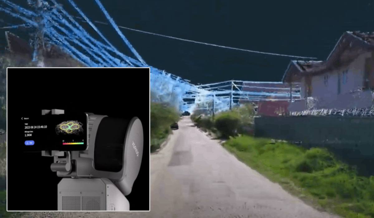
The scanner's design combines a 32-channel LiDAR, two panoramic 48 MP cameras, an IMU module, and artificial intelligence. This enables the formation of real-time color point clouds with quality close to post-processing, using the LixelUpSample™ algorithm. As a result of 3D scanning with the XGRIDS L2 Pro 32/120, we get a digital model of high density and accuracy, allowing its immediate use without post-processing.
Technical Parameters of XGRIDS L2 Pro 32/120
- Scanning range: up to 120 m (minimum from 0.5 m)
- Scanning speed: up to 640,000 points/sec (32 channels)
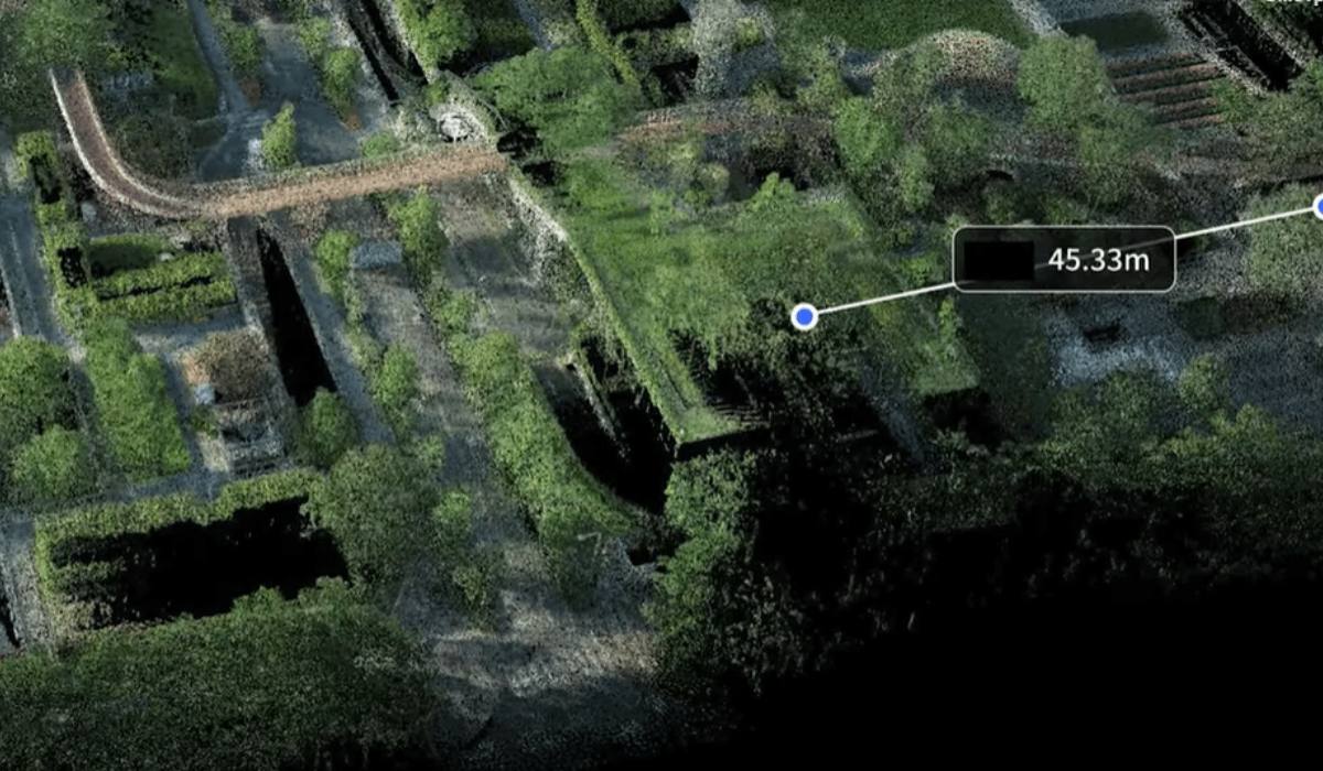
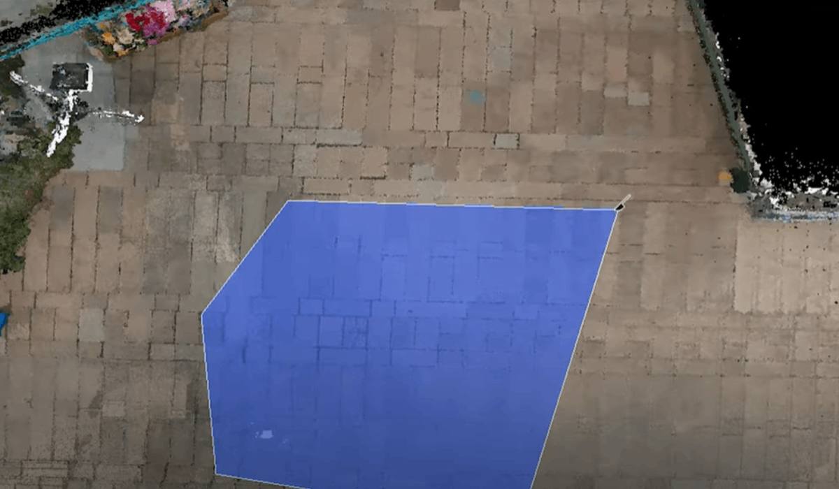
- Cloud density: up to ~1 million points/m², step ~1 mm, thickness ~5 mm
- Accuracy: relative ~1 cm, absolute ~3 cm
- Field of view: 360° horizontal × 270° vertical
- Cameras: 2 × 48 MP panoramic cameras, providing realistic color coverage
- Memory: built-in 1 TB SSD
- Power and autonomy: 46.8 Wh (Li-Ion) battery, up to 1.5 hours of operation; charger included
- Performance: power consumption < 30 W, operates at temperatures from –20 °C to +50 °C, IP54 protection rating
- Weight and dimensions: approximately 1.7 kg (without battery), dimensions ~180 × 130 × 400 mm

Features and Advantages of the XGRIDS L2 Pro 3D Scanner for Construction
- Zero post-processing: the combination of LiDAR, cameras, and AI processes data streams in real time, without additional processing (zero-post-processing)
- Photorealistic color cloud: thanks to the LixelUpSample™ algorithm, scans look like post-processed ones
- Intuitive control: control via the built-in screen and the LixelGO app on a smartphone, with pause/resume scanning function, RTK setup, and data preview available
- RTK-geopositioning support: possibility to connect an RTK module (standard or Survey Grade) to ensure high georeferencing in difficult conditions
- Multitasking and mobility: lightweight design, autonomous operation, high data collection speed — suitable for field and indoor conditions.
Portable Scanner for Large Objects – Areas of Use
- Engineering and construction: BIM, construction monitoring, facades, and interior objects.
- Cartography and geodesy: topography, digital terrain models, cadastral surveying with RTK referencing.
- Urban planning and architecture: 3D models of urban objects, facades, infrastructure.
- Cultural heritage: highly detailed scanning of monuments, architectural landmarks, museums.
- Agriculture and forestry: digital modeling of forests, agricultural lands, vegetation monitoring.
- Film, VR/AR, games: creation of realistic scenes, textures, and high-resolution environments.
- Emergency situations and forensics: recording accident scenes, fast remote shooting in difficult conditions.
Architecture and Construction
The scanner is ideal for:
Creating BIM models: collecting high-precision 3D data of buildings and construction sites for modeling in Revit, ArchiCAD, AutoCAD, and other systems.
Monitoring construction progress: regular scanning allows tracking deviations from project plans.
Scanning facades and interiors: thanks to high resolution and color point cloud, even small architectural elements can be captured.
Emergency situations, emergency services, military tasks
Rapid 3D scanning of accident zones: collapses, floods, fires, allowing quick planning of rescue operations.
Mapping minefields and destroyed territories: autonomous operation without GPS makes the scanner ideal in areas with poor connectivity.
Damage assessment and reconstruction planning.
The XGRIDS L2 Pro 32/120 is a universal solution for dozens of tasks where mobility, speed, and accuracy are required. Thanks to intelligent data processing and autonomous operation, it's suitable for both field and stationary measurements in a wide variety of areas.
Geodesy and Cartography
Creating topographic maps: autonomous operation and RTK-referencing allow for quick and accurate terrain surveying.
Modeling territories: the scanner covers up to 120 m in a circle, making it suitable for surveying large areas.
Cadastral surveying: high accuracy and georeferencing support make the device effective for collecting data for cadastral maps.
Urban Planning and Infrastructure
Documenting urban environments: scanning streets, buildings, engineering objects, bridges, interchanges.
Planning and reconstruction: data is used in designing new objects within existing urban environments.
Inventory of infrastructure objects: recording the condition of roads, curbs, utility networks, lighting, etc.
Cultural Heritage and Museums
3D digitization of monuments and architectural objects: the scanner allows capturing the smallest details thanks to the high density of the point cloud.
Creating virtual tours and archives: color point clouds make it possible to recreate objects in VR, AR, and 3D visualizations.
Restoration: accurate object data allows creating 3D models for recreating lost elements.
Forestry and Agriculture
Vegetation monitoring: assessing biomass, tree height, stand density.
Planning plantings and land use: scanning terrain and the environment helps in planning irrigation and calculating work volumes.
Analysis of erosion and water runoff: digital landscape models allow modeling water flows and erosional processes.
Industry and Engineering Surveys
Technical inspection of objects: analysis of buildings, pipelines, tanks, quarries.
Scanning complex industrial spaces: accurate 3D representation of workshops, machine-building installations, warehouses.
Planning reconstructions and installations: 3D data is used in designing new components for existing infrastructure.
Medicine and Forensic Examination
Recording accident scenes: 3D documentation of road accidents, crimes, fires for subsequent analysis.
Forensic visualization: creating evidentiary models for presentation in court.
Medical visualization (limited): digitization of anatomical objects and pathologies.
VR/AR, Cinematography, Game Design
Creating realistic game and movie scenes: accurate 3D data of cities, rooms, objects.
Developing virtual exhibitions and presentations.
Photorealistic scans for CGI, including textures, geometry, lighting information.

XGRIDS L2 Pro 32/120 3D Scanner Package Contents*
- XGRIDS L2 Pro 32-channel scanner (range up to 120 m)
- L2 Series rechargeable battery (~46.8 Wh), provides up to 1.5 hours of autonomous operation
- Charger with converter
- GCP plate (control point marking)
- USB-C cable for data transfer
- Durable transport case
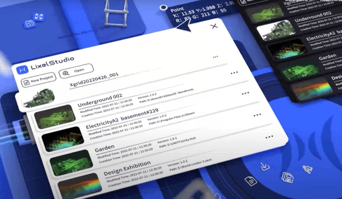
- License for Lixel Studio software (for visualization and processing)
- Quick start guide
- Warranty card (~12 months)
- Cleaning cloth
*The manufacturer may change the product's package contents without notice, so please confirm the contents of the box with your manager when placing your order.
Software for the XGRIDS L2 Pro 3D Scanner
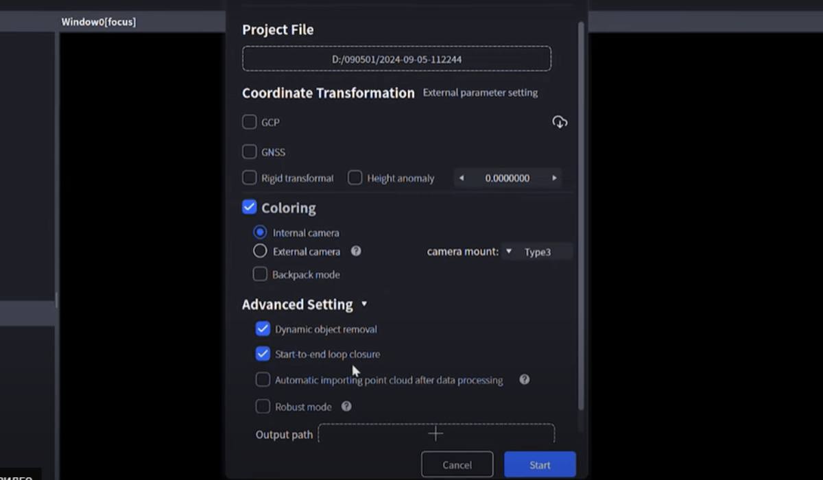
The XGRIDS L2 Pro 32/120 3D scanner comes with a powerful set of software solutions designed for maximum performance and user convenience. The primary data processing tool is Lixel Studio — specialized software for visualizing, filtering, and exporting color point clouds. It supports .LAS, .PLY, .XYZ formats and can be integrated with systems like Autodesk ReCap, CloudCompare, Bentley, Pix4D, and others.
Additionally, the Lixel GO mobile app is available, which allows real-time scanning control, viewing, and parameter adjustment directly on a smartphone or tablet. The built-in AI processing system (LixelUpSample™ algorithm) combined with the software eliminates the need for lengthy post-processing, and the "one-click colorization" function provides an instant photorealistic color display of the point cloud. The ability for RTK georeferencing and visualization of the scanning route on a map is also provided.
The software is constantly updated and adapted to new formats, making the XGRIDS L2 Pro especially flexible and suitable for integration into any workflow.
Choosing the 32/120 Model: 4 Key Advantages
- Optimal balance of range (120 m) and density (640,000 points/sec) — perfectly suited for both large open areas and detailed indoor tasks.
- High resolution (up to 1 mm/point) makes this model versatile for engineering and cultural projects.
- Reliability and autonomy: autonomous operation up to 1.5 hours, IP54 protection, wide temperature range.
- Real-time visualization and control simplify work in the field.
The XGRIDS L2 Pro 32/120 is a high-precision, mobile, and reliable set of technologies for professional 3D scanning. It ensures maximum efficiency by combining LiDAR, AI modules, and cameras, creating color point clouds with virtually no post-processing. The scanner is especially relevant for engineering tasks, cultural heritage, cartography, VR projects, and emergency situations. The package includes everything necessary for launching and operating right out of the box. Optional accessories for the XGRIDS L2 Pro 32/120 3D scanner are also available. Call or write to us – we'll gladly help you select everything you need for productive work with your digital equipment!


